

This Map Will Show You How Long it Takes to Get to Anywhere in Colorado From Denver
I found this really cool map online showing you approximately how much time it will take you to get anywhere in the state of Colorado from Denver. Specifically the Cherry Creek Mall to be exact. Whether you are going to the southwest city of Durango or the southeast most city of Julesburg this map shows it all. Click the image for a larger resolution:
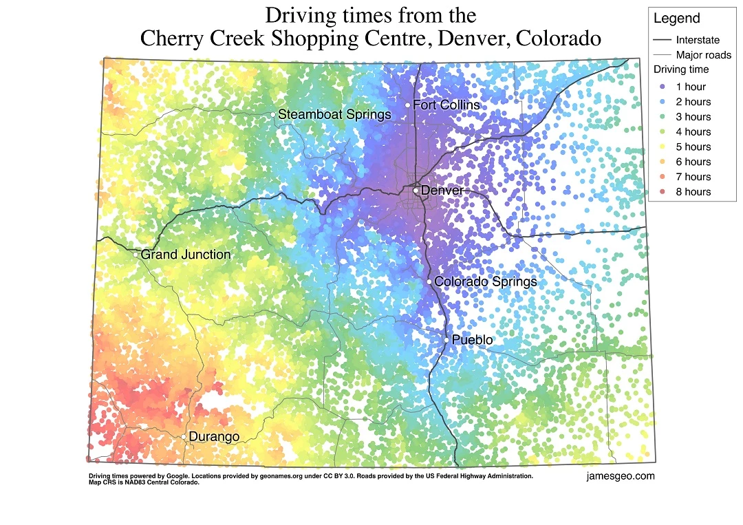
Now, I am sure this doesn't take into account the crazy traffic that Denver has or the gnarly mountain traffic when it is ski season. However, it does give you a pretty good idea on how long it will take you to get to the Mile High City from anywhere in our state! Not to mention... It's got some pretty cool colors on the map as well!
More From 99.9 The Point


![A Creepy Clown Recap: Where Have Clowns Been Sighted in Northern Colorado? [MAP]](http://townsquare.media/site/48/files/2016/10/Untitled-design-7.jpg?w=980&q=75)
![Can You Identify These Northern Colorado Cities Based on Google Street View? [QUIZ]](http://townsquare.media/site/50/files/2015/12/ftc.jpg?w=980&q=75)