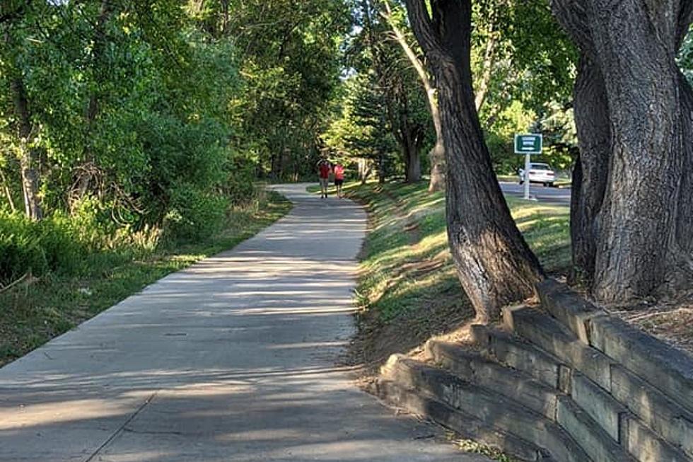

See Our Top Five Fort Collins Hiking Trails
Fort Collins is a nice place to sit down, have a beer, and forget about the world at large. It's also a nice place to meet people, ride your bike, or go to college. If you hate all that, you still have one option: hiking.
Hiking will get you away from all the people, bikes (unless you stumble across some mountain-bikers), college students, and beer (unless you bring your own beer hiking). Let's say you want to get away, but don't know where to go. We got you covered. Here are (my personal favorite) five hiking trails that will get you away (though not too away, don't want to miss Top Gear reruns) and hungry for more.
And if you enjoy the outdoors as much as the next bearded-lumberjack type, maybe check out the Great Colorado Outdoors Show coming up this August. There will workshops and people selling fishing poles and all sorts of goodies. Check it out. Now for the hiking trails...
Grey Rock
First off we have a nice little hike named Grey Rock; so named for the enormous grey rock that the trail leads you too. The hike loop is a little over seven miles long, so chances are it will be an all day thing. My favorite part of the hike is after you reach the rock and climb to the top, you are greeted with a little pond. You can swim in the pond, but it may be a little shallow later in the summer.
Directions:
Drive North on the Poudre Canyon Road to the Greyrock Mountain Trailhead (about 25 miles from Fort Collins). Hop out of your car, cross the river to grandmother's house you go. Be careful not to lose track of the trail coming down off the rock, and always go prepared with lunch in hand.
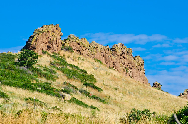
Flatirons Hike
The Boulder Flatirons are one of the staples of Northern Colorado. You don't have to enjoy Boulder to enjoy this hike. It will take your right up the side and to the top of the second flatiron (second rock from right in picture). If you are very brave (seriously, I can't do it), you can actually climb up the face of the same rock. I have been with friends who have done it multiple times, but my slight fear of heights shows it's face every time I try. I take no responsibility for those of you that wish to try the more direct route, but if you do it, you won't forget it.
Directions
Take I-25 South to Boulder. Take the exit for the Diagonal Highway to Boulder, then take Highway 36 (28th Street) South. Get off on Baseline Road and take Baseline Road West. Park behind Chautauqua Park on Kinnikinic Road near the trailhead. (Click here for a marker of Chautauqua.) Follow the path toward the flatirons. Follow the trail and so forth until you reach the top. Return. If you wish to try the face-climb, there is a point in the trail where you will be at the base of the flatiron, this is where you start. I hope you wore the right shoes.
Devil's Backbone
The Devil's Backbone is an aptly named set of rocks that, if seen from the appropriate angle, appear like a backbone protruding from the Earth. The hike is actually pretty easy, consisting mostly of just a wandering path that leads up to the hill where the rocks sit. This is one of those hikes that makes for a great cheap date if you go during sunrise or sunset and bring a small picnic.
Directions
Head South to Loveland, take the exit for Eisenhower Boulevard and go East. Follow the signs for the Devil's Backbone Open Area. Hike, rinse, repeat.
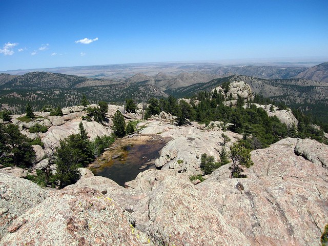
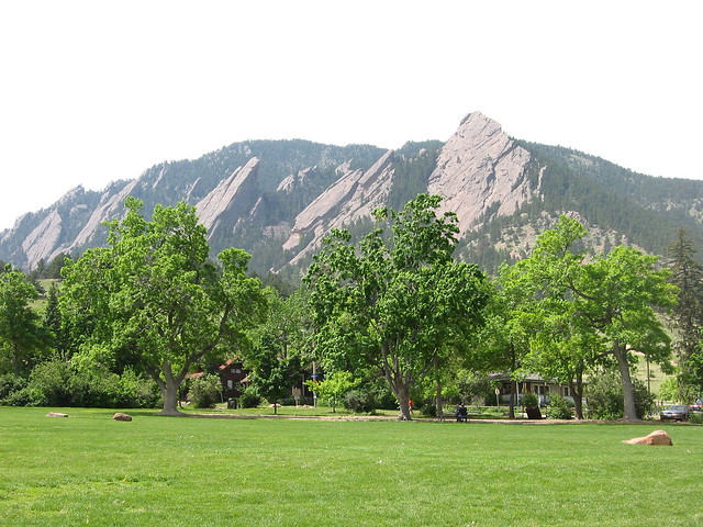
Arthur's Rock
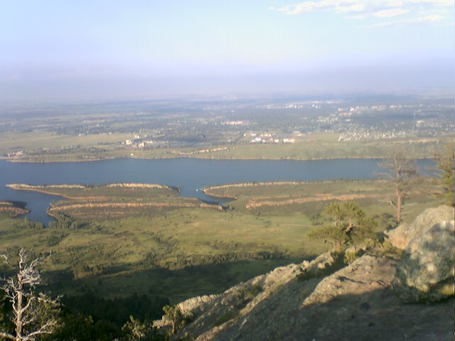
Arthur's Rock is technically located in Bellvue, but who's counting. The trail is located behind the Horsetooth Reservoir, and gives a scenic view of the lake from a new angle (see above picture). The hike falls on the same difficulty as Devil's Backbone; not very difficult. It is a good hike to enjoy on a Saturday afternoon or a Sunday evening before going back to the rat race.
Directions
From Fort Collins, head East on Harmony Road to CO Road 38 (will lead you past Horsetooth). Turn Right onto CO Road 25 East, park, hike, enjoy.
Young's Gulch
What does it take to get a trail named after yourself? This hike is again, moderate. At not quite five miles, it is a good trail to hike with out-of-towners if you like to hear them complain about the lack of oxygen in this part of the country.
Directions
From Fort Collins, take College North and follow it until you get to Rist Canyon Road. Follow Rist Canyon Road (CO Road 52 East) until Stratton Park Road. Follow the signs, hike, don't get lost, eat a sandwich, hike back, bring plenty of water, return home, take a nap.
Don't forget, if being outside and away from the people is your thing, be sure to check out the Great Colorado Outdoors Show for chances to buy new ATVs and climbing gear.
More From 99.9 The Point